The Drone That Knows When the Forest is Thirsty
December 10, 2025A new method makes it possible to detect water stress in trees without touching the leaves
In an era when sensors, cameras and drones can view and measure things with increasing accuracy and sophistication, forests, too, are beginning to speak a digital language. A new Israeli study offers a way to understand what is happening to trees without touching them at all. It doesn’t rely on cumbersome measuring devices or outdated leaf sampling, but on drones flying over the treetops, using advanced cameras and artificial-intelligence technology. This approach makes it possible to learn how much water the trees contain, which trees are beginning to suffer from drought conditions, and where intervention is required before it is too late. Could it be that in the near future we will be able to monitor forest health in real time, without ever setting foot in the field?
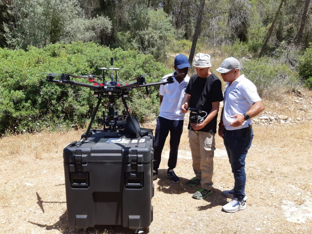
Photo: Netanel Fishman
The new study, which was presented at the 2025 KKL Research Conference, was published in the academic journal Remote Sensing. It is an extensive project funded by the KKL Chief Scientist, conducted by a team of nine researchers from the Hebrew University and the Weizmann Institute of Science, led by Dr. David Helman of the Plant Systems Modeling and Monitoring Laboratory at the Hebrew University’s Faculty of Agriculture, Food and Environment. “The goal of the study was to develop an innovative method for early detection of water stress in trees in Mediterranean forests, which are increasingly affected by climate change,” explains the lead researcher, Yehuda Yungstein.
The need for advanced monitoring methods is becoming more urgent than ever. In recent decades, drought events in Israel and across the Mediterranean region have become more frequent, spreading even into areas that were previously considered more resilient to dryness. According to Israel Meteorological Service data, recent years have seen a high frequency of prolonged dry periods and rising summer temperatures, trends that are intensifying as the climate crisis worsens. This shift directly affects forest ecosystems, which struggle to adapt to the rapid pace of change.
Monitoring Without Touching
The new research emerged from the need to understand, in real time, how trees respond to environmental stress and to develop tools that help protect them. “In the experiment, we combined standard physiological measurements of trees – such as carbon-fixation rates, leaf water potential and leaf transpiration – with drone imagery and machine-learning algorithms, in order to test whether we could identify signs of stress before they become visible or measurable by conventional means,” Yungstein explains.
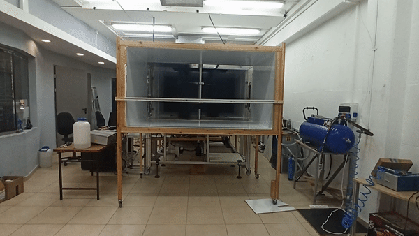
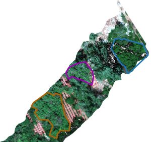
The experiment took place in the Yishay Forest in the Judean Mountains – a Mediterranean forest rich with various species, including pine, oak, carob, cypress and pistacia. As part of the experiment, precipitation was reduced artificially by about 50 percent using a controlled rain-collection system designed to simulate drought conditions. The researchers developed an innovative method for evaluating the trees’ water status using a drone equipped with a hyperspectral camera that captures light reflected from the leaves in hundreds of wavelengths, including those not visible to the human eye. “The method is based on a camera that images the leaves in 274 different channels. The results showed that the model we developed was able to identify trees under stress with about 85 percent accuracy, even when conventional physiological measurements showed almost no change. The most accurate model could distinguish between healthy and stressed trees using just 21 of the 274 measured channels,” he says.
In the year-long experiment, during which drone-based data were collected, machine-learning algorithms and artificial intelligence made it possible to determine the trees’ water status based on the colors and light they reflect. “Using machine learning, you can train the computer to recognize these differences with very high precision,” Yungstein notes. According to him, artificial intelligence makes it possible to convert vast amounts of data into a clear, objective index of tree condition – a breakthrough compared with traditional manual measurements, which are slow and expensive.
The Sky Is Not the Limit
The model developed in the study may also be used to analyze high-resolution satellite images, opening the door to large-scale monitoring of forests in the Mediterranean region and around the world. “A drone enables precise scanning of the forest at a resolution of just a few centimeters, while a satellite can cover far larger areas, though at a coarser resolution,” Yungstein explains.
Although further research is needed to test the method’s effectiveness in additional forest types, this is already a significant step toward non-invasive monitoring of forest health based on artificial intelligence. According to Yungstein, this advanced technology has the potential to transform forest management in Israel. “Organizations like KKL and the Israel Nature and Parks Authority will be able to use it as an early-warning tool for identifying areas at risk of drought, enabling timely intervention,” he says. “Since the system can also operate on satellite data, it is suitable for continuous monitoring and nationwide coverage, and will allow smart, accurate and data-driven management of forest resources.”
Dr. Yehonatan Bar-Yosef, a hydro-ecologist in the KKL Chief Scientist’s Office, summarizes: “The researchers – Dr. David Helman of the Faculty of Agriculture in Rehovot and Prof. Tamir Klein of the Weizmann Institute – have succeeded in establishing a method in which remote sensing of leaf water potential via satellite makes it possible to spatially identify forest plots under water stress a year or two before actual mortality occurs. This capability enables early warning and timely management actions in the affected plots.”

“Food Security is National Security”
On the first day of the 52nd Annual Conference for Science and the Environment, over 220 workshops, panels, and lectures took place, and a lifetime achievement award was presented to Prof. Moshe Shachak. What did we experience on the conference's second day?
Say No to Overflow: a Solution Against Floods?
A new Israeli invention – rainwater storage tanks to be placed on residential buildings and controlled by a computerized system – may reduce the load on the drainage systems in cities, thereby helping to minimize the dangerous floods Israel has encountered in the recent winters